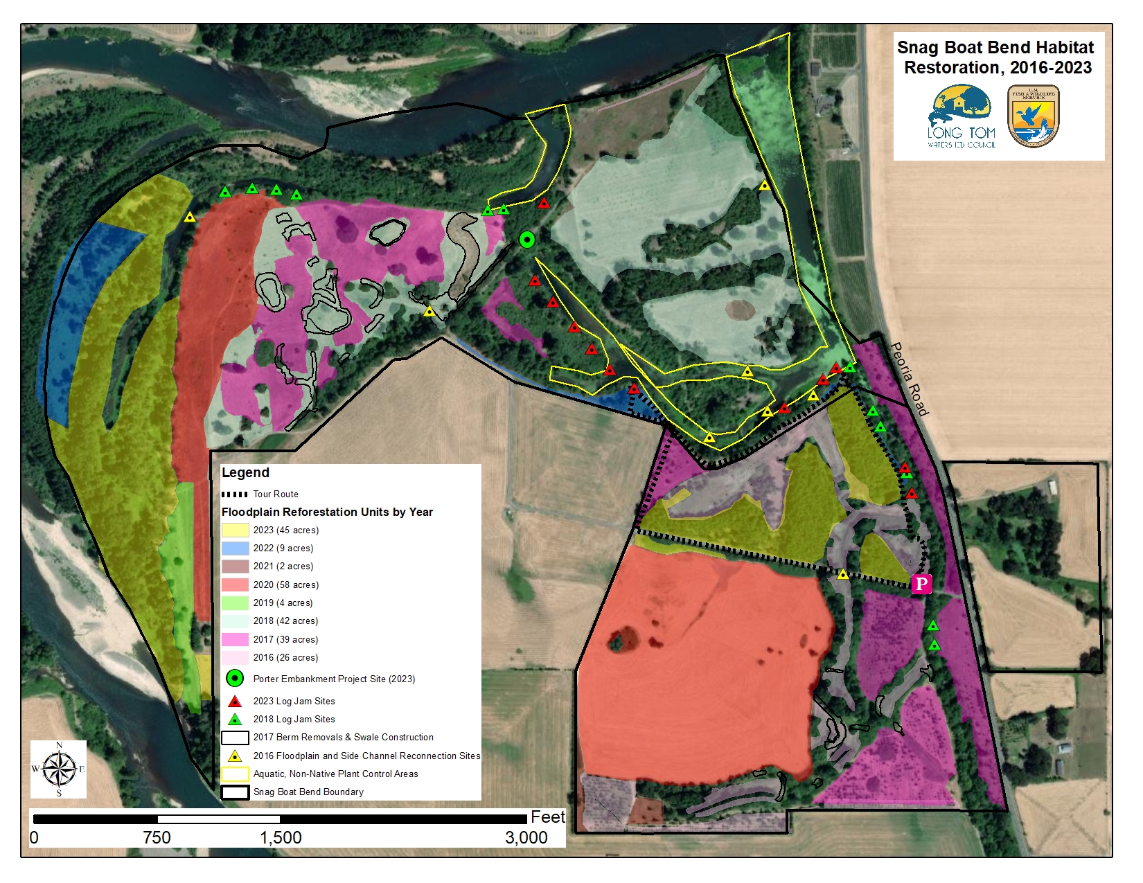
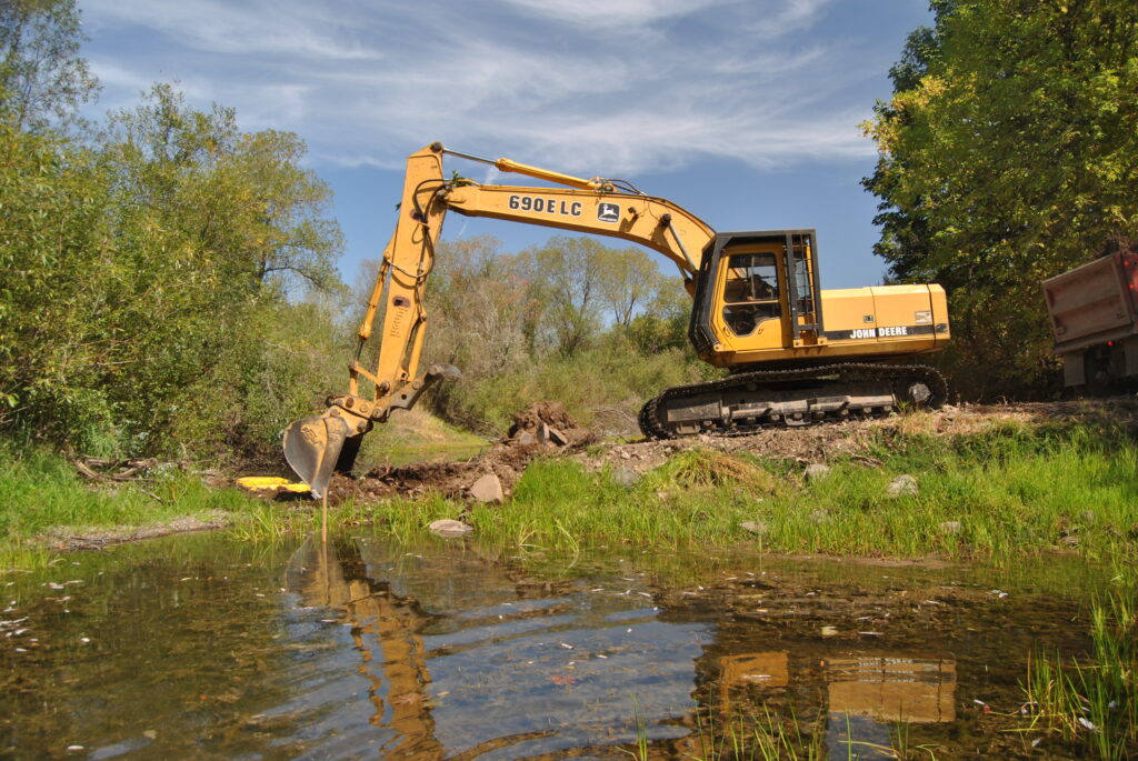
Snag Boat Bend is a 341-acre unit of William L. Finley National Wildlife Refuge, and is owned and managed by the U.S. Fish and Wildlife Service. It is located just across and downstream of the historic mouth of the Long Tom River, on Peoria Road between Harrisburg and Corvallis. It is open to the public and has a number of trails you can walk to check out the extensive habitat restoration work LTWC is working on with USFWS. As of 2025, we have replanted 220+ acres of floodplain that was historically forested before conversion to agriculture. In addition to the reforestation activities, we have worked to reconnect the river to its floodplain, remove passage barriers for aquatic species, and eliminate fish stranding risks by removing constructed features at 10 sites that disconnected 50+ acres of side channel and floodplain habitat. We have completed other work to enhance habitat complexity in off-channel areas like side channels and alcoves. Activities have included removing constructed berms and water control structures installed by previous landowners for waterfowl hunting, replacing an 18” culvert with an 18.5’ wide concrete box culvert, excavating a floodplain swale to provide high-flow refuge habitat for juvenile fish, and installing 12 log jams in Lake Creek and Willamette River alcoves.
We are currently working on a project to reconnect the Willamette river to over a mile of its historical channel that was disconnected when a large revetment was installed by the U.S. Army Corps of Engineers to reduce bank erosion on the property when it was privately owned in 1964. A new, straight channel for the Willamette River was excavated to move the river away from the eroding bank, and the excavated material was used to build the revetment, which cut off the upstream inlet to the 1.1 mile long historical channel. The historical channel backwaters from the mainstem Willamette and has little to no velocity, which has reduced water quality by increasing temperatures and allowing non-native aquatic plants like Uruguayan water primrose willow (Ludwigia hexapetala) to invade the area. As this vegetation dies and decomposes, the channel has filled with decomposing organic matter and fine sediment. The slack, warm waters are favorable to non-native warmwater fish species like largemouth bass, which prey on native fish like juvenile spring Chinook as well as native amphibians and juvenile northwestern pond turtles. The goal of the project is to increase water velocities slightly in the historical channel to flush out the accumulated fine sediments and improve conditions for native species.
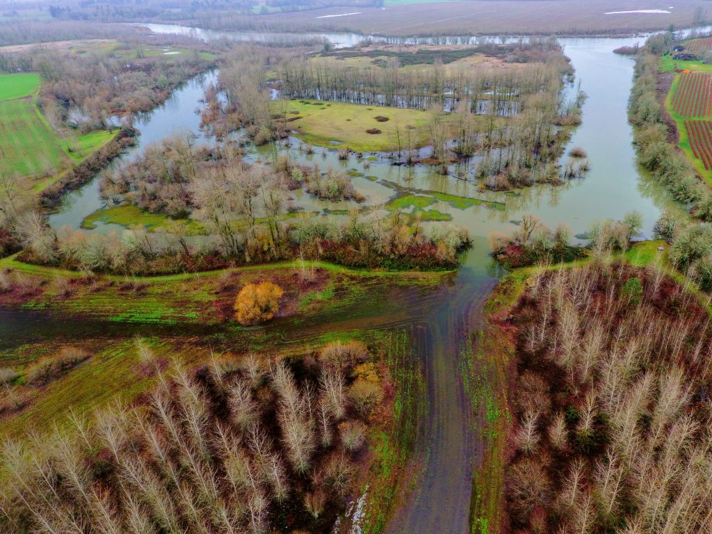
The project, scheduled to be implemented in summer 2026, will remove a section of the revetment to allow a controlled amount of flow into the historical channel. The project design has been reviewed extensively by the Army Corps of Engineers to ensure that it will not increase bank erosion along the outside bend of the historical channel. The adjacent field was likely farmed with annual crops and the bank was bare ground when the revetment was built, reducing the stability of the bank. It is fully vegetated now, with mature native trees and shrubs, and 12 log jams will be installed along the outside of the bend of the historical channel to increase habitat complexity and further stabilize the bank.
We have been collecting pre-project monitoring data to compare with data collected after the project is complete, to learn about the effects of the project. This data includes summer water temperature upstream and downstream of the revetment, cross sections and substrate characterizations of the channel, and stream flow.
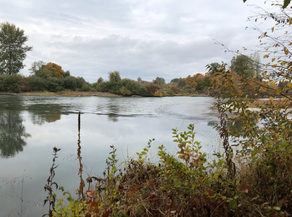
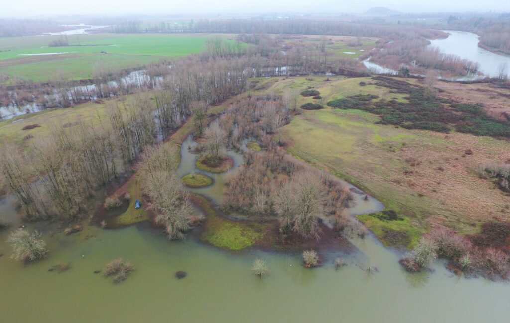
Photo by SWCA Environmental Consultants